Three Storms in Three Weeks: Henry, Inday, Kiyapo, and the July 2026 Habagat
news27-07-2026

July 2026 was a reminder that a typhoon does not have to make landfall near you to cause damage where you live. Three tropical cyclones passed through or near the Philippine Area of Responsibility (PAR) in the first four weeks of the month. The strongest of them never touched land here at all, yet the rains it pulled in triggered deadly landslides in Mindanao, at the opposite end of the country from its track.
This post covers what happened, where the damage landed, and what expats can learn from it before the rest of the typhoon season.
First, a Word on Names and the Habagat
Every storm in the region has two names. The international name comes from the Japan Meteorological Agency’s list; PAGASA, the Philippine weather bureau, assigns a separate local name when a storm is inside the PAR. Philippine news reports use the local name, foreign wire reports use the international one, and it is easy to think two storms are involved when there is only one.
- Maysak = Henry
- Bavi = Inday
- Noul = Kiyapo
The other actor is the habagat, the southwest monsoon. From roughly June to September it brings moist air and rain to the western side of the country. When a typhoon passes to the north or east, it can “pull” and strengthen the habagat, so the heaviest rain often falls far from the storm itself. That is what happened repeatedly in July.
Henry (Maysak): A Brief Visitor
According to PAGASA’s preliminary report, Henry was only a tropical depression while inside the PAR and left on July 1. It strengthened over the South China Sea and, per PAGASA, made landfall over Quảng Ninh in northern Vietnam on July 4. Al Jazeera later reported that flooding in Nanning, southern China, after a dam breach killed 39 people. Henry’s direct impact on the Philippines was minor; its main role was to keep the monsoon active as the next storm approached.
Inday (Bavi): No Landfall, Many Deaths
Bavi was a super typhoon when it hit the Northern Mariana Islands on July 6, local time. On July 6, the Philippine Star reported PAGASA’s estimate of maximum sustained winds of 215 km/h and gusts up to 265 km/h, and PAGASA’s forecast that the storm, named Inday once inside the PAR, was unlikely to make landfall in the Philippines.
That forecast was right. Inday entered the PAR early on July 8, passed east and north of Luzon, and left on July 11 before making landfall in Zhejiang, China. Wind signals went up across northern Luzon, peaking at Signal No. 2 over Batanes and the eastern Babuyan Islands.
The damage came from rain, enhanced by the habagat:
- On July 10, Al Jazeera, citing the Philippine News Agency, reported that a landslide killed 10 people in Malapatan, Sarangani, and another killed at least five in Lanao del Sur.
- Metro Manila roads flooded too. On July 10, MMDA updates compiled by GMA News showed mostly gutter-deep flooding on EDSA tunnels and service roads, España, and Taft Avenue, with above-knee water at Valle Verde in Pasig that was not passable.
The Death Toll: Counts Differ
The numbers grew as reports came in, and sources differ, so here is how they evolved:
- 15 – Al Jazeera, July 10 (two landslides)
- 17 dead, about 514,000 affected – NDRRMC, July 11, reported by the Philippine Star
- 20 dead, 16 missing – NDRRMC, July 13, reported by SunStar
- 23 dead – the figure used by Wikipedia’s summary of the storm, citing a July 14 NDRRMC report
- 26 dead, 14 missing, more than 1 million people affected – Office of Civil Defense, July 15, reported by the Daily Tribune
Two cautions. First, the official counts combine the effects of Inday and the habagat, so not every death is attributable to the storm itself. Second, the OCD said validation of casualties was still ongoing. By the July 15 report, deaths had been recorded in Sarangani (10), Lanao del Sur (7), Davao Occidental (4), Zamboanga Sibugay (2), Bukidnon (2), and Iloilo (1). The OCD also reported 766 houses totally destroyed and 853 partially damaged, and about 22,000 people in evacuation centers.
Kiyapo (Noul): Landfall in Cagayan
The third storm formed east of Luzon around July 22 and was named Kiyapo. According to the Philippine Star:
- Kiyapo became a tropical storm around 2 a.m. on July 24.
- It made landfall at 2:10 p.m. that day on Camiguin Island, in Calayan, Cagayan, with maximum sustained winds of 85 km/h and gusts of 115 km/h.
- Signal No. 2 was raised over Batanes, northern Cagayan including the Babuyan Islands, northern Apayao, and northern Ilocos Norte.
- Preemptive evacuations were carried out in three Cagayan towns.
Kiyapo left the PAR on July 25 and later made landfall in southern China as a typhoon.
Once again, much of the damage was far from the landfall, driven by the enhanced habagat:
- GMA Regional TV reported flooding in Iloilo City, Antique, Cebu, and Sarangani, a creek surge in General Santos City, a damaged bridge in Lanao del Sur declared “unsafe and impassable,” and a landslide that blocked the Maitum–Lake Sebu road in Sarangani.
- The Philippine Star reported that in Western Visayas, 1,380 schools shifted to remote learning, affecting 481,034 learners, and that the PCG rescued at least 20 people from floodwaters in Antique and Guimaras.
- As of the NDRRMC report of July 26, Kiyapo had left 3 dead (one in Davao, two in Sarangani) and 1 missing, with about 285,000 people affected and 261 homes damaged. As with Inday, those figures were preliminary.
Cities vs. Provinces
The same storm produces very different experiences depending on where you are.
In the Cities
- Flooding is fast, but usually shallow and short. In Metro Manila on July 10, most flooded roads were gutter-deep and passable; a few low spots were not.
- Class suspensions come quickly, usually announced by the local government the night before or early in the morning. On July 24, suspensions were announced from Pagudpud to General Trias, Silay City, and several Mindanao provinces.
- Traffic is the biggest daily disruption. A flooded underpass or service road can turn a 30-minute commute into a three-hour one.
- Recovery is quick. Power, water, and roads in cities generally come back within hours or a day or two.
- Not every “city” is Manila. This month, Iloilo City, General Santos, and Davao City saw serious urban flooding.
In the Provinces
- Landslides are the deadliest hazard. Both of July’s deadliest incidents were landslides in Mindanao mountain communities, not wind or storm surge.
- Isolation. A single blocked road or damaged bridge, like the Maitum–Lake Sebu road or the Maladi Bridge in Lanao del Sur, can cut off barangays for days.
- Crops and livelihoods. Rice fields, fishponds, and small farms take the hit. Agricultural damage reports usually rise for weeks after a storm.
- Power and water take longer to restore. Rural electric cooperatives cover large areas with fewer crews, and fallen lines in mountain areas are slow to reach.
- Fishing stops. When signals and gale warnings go up, small boats stay in port, and income stops with them.
What It Means for Expats
The main lesson from July: do not judge your risk by where the storm is. Judge it by the rain forecast and the terrain you live on.
Understand the Warnings
- PAGASA Tropical Cyclone Wind Signals (Signal No. 1 to No. 5) are about wind. A low signal, or no signal at all, does not mean no danger.
- PAGASA rainfall warnings (yellow, orange, red) and flood and landslide advisories are often more relevant, especially during habagat season.
- The NDRRMC sends emergency alerts directly to mobile phones. Do not swipe them away without reading them.
- Follow your city or municipal DRRM office and local government Facebook page. Class suspensions, evacuation orders, and road closures appear there first.
Prepare Before the Season
- Know your terrain. If you live on or below a slope, near a river, or in a low-lying subdivision, ask neighbors and the barangay where water goes and which slopes have moved before.
- Keep a go-bag. Documents (passport, visa, ACR I-Card) in a waterproof pouch, cash, medicine, water, a flashlight, and a power bank. See our guide to the expat bug-out bag for rural Philippines.
- Plan for power outages. In the provinces, restoration can take days. A generator needs fuel stored, a tested start, and a safe outdoor location. For what can go wrong, see the time the generator died during a typhoon.
- Protect electronics and connectivity. A UPS and spare batteries keep a router and laptop running through brownouts; see our post on UPS batteries and IT equipment during outages.
- Stock up early. Water, rice, canned food, and fuel run short quickly once a signal is raised.
Insurance
- Health insurance matters more after a storm, when injuries and illnesses (including leptospirosis after wading in floodwater) rise.
- Property insurance does not always cover flood, typhoon, or landslide by default. Check the policy wording.
- Car insurance usually needs an “acts of nature” add-on to cover flood damage.
When a Storm Is Coming
- Do not travel by sea when gale warnings or signals are up. Ferries will be cancelled anyway.
- Avoid mountain roads during and after heavy rain. Landslides often happen after the rain has stopped.
- Do not wade through floodwater if you can avoid it.
- If local officials call a preemptive evacuation, go. They know which slopes and riverbanks have failed before.
Summary
- Henry (Maysak) brushed the PAR as a tropical depression at the start of July.
- Inday (Bavi) never made landfall in the Philippines, but its rain, combined with the habagat, killed between 15 and 26 people depending on the report and date, mostly in Mindanao landslides.
- Kiyapo (Noul) made landfall at Calayan, Cagayan, on July 24; the enhanced habagat brought flooding to the Visayas and Mindanao, with 3 dead and 1 missing in the July 26 NDRRMC report.
- Cities flooded and suspended classes, but recovered quickly. Provinces faced landslides, cut-off roads, and slower restoration.
- For expats: watch rainfall warnings as closely as wind signals, know your terrain, and prepare for power outages before the season peaks.
Sources
- PAGASA: Tropical Cyclone Preliminary Report, Severe Tropical Storm Henry (Maysak)
- Philippine Star: Super typhoon may enter PAR as Inday, but unlikely to hit land, PAGASA
- Al Jazeera: Philippines landslides kill 15 as Typhoon Bavi threatens region
- GMA News: LIST: Flooded areas in Metro Manila on July 10, 2026
- Philippine Star: 17 dead, over 514,000 affected by Typhoon Inday, habagat (NDRRMC)
- SunStar: Typhoon Inday death toll climbs to 20, 16 still missing
- Daily Tribune: Death toll from Inday, Habagat rises to 26: OCD
- Wikipedia: Typhoon Bavi (2026)
- Daily Tribune: Walang Pasok: Class suspensions on 24 July due to Kiyapo, intensified habagat
- GMA Regional TV: #KiyapoPH, monsoon trigger floods, road damage across Philippines
- Philippine Star: Kiyapo makes landfall in Cagayan, exits PAR today
- Philippine Star: 3 dead, 1 missing due to Kiyapo (NDRRMC)
- Wikipedia: Typhoon Noul (2026)
Thinking of Moving to the Philippines? Get Reliable Guidance
Online communities are helpful for general questions. For anything important, you still need accurate, professional, and updated information. E636 Expat Services helps foreigners with:
- Residency and long term visas
- Bank account opening
- Health insurance guidance
- Real estate assistance
- Business setup
- Retirement planning
- A smooth and secure transition into life in the Philippines
If you want to move with confidence instead of relying on random comments online, we can guide you every step of the way.
Book a consultation with E636 and start your journey the right way.
Image credits (via Unsplash, free under the Unsplash License):
- Top image: “a large storm moving across the sky over a body of water” by Daniel Lerman
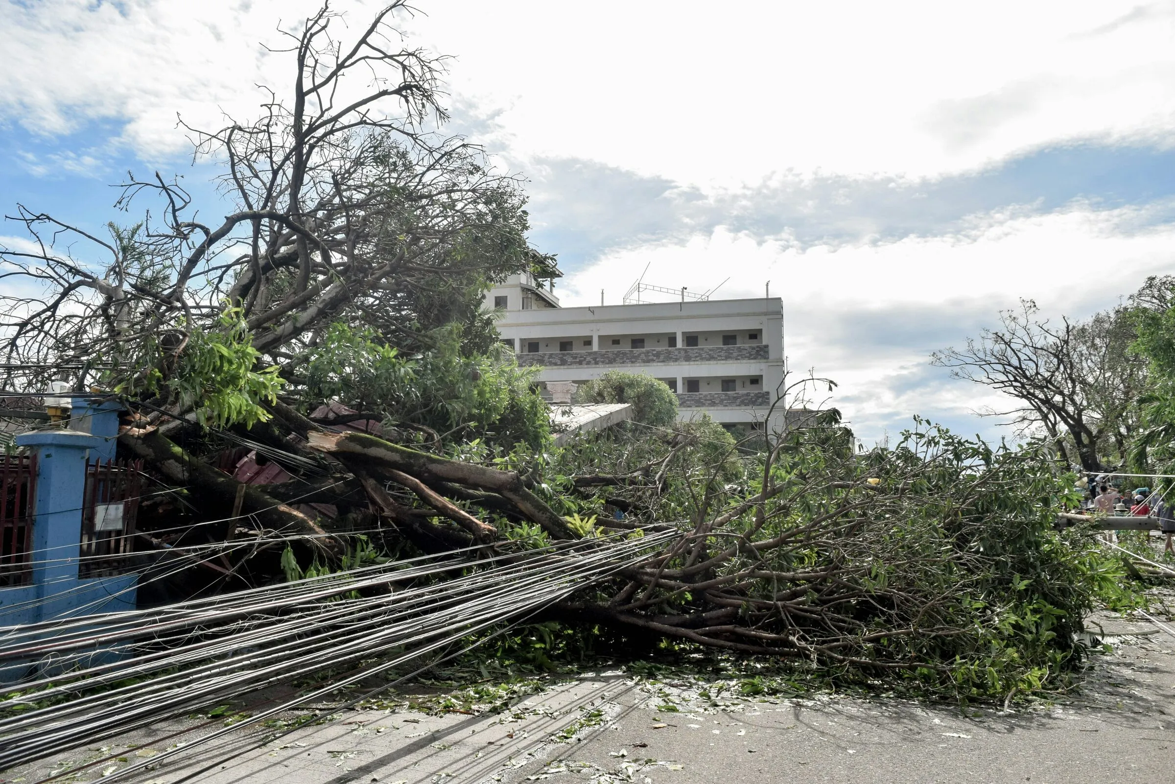
- Cities vs. Provinces section: “a large tree that has fallen on top of a building” by Carl Kho